The Endless Sparkling of The Ocean

IMG_6696

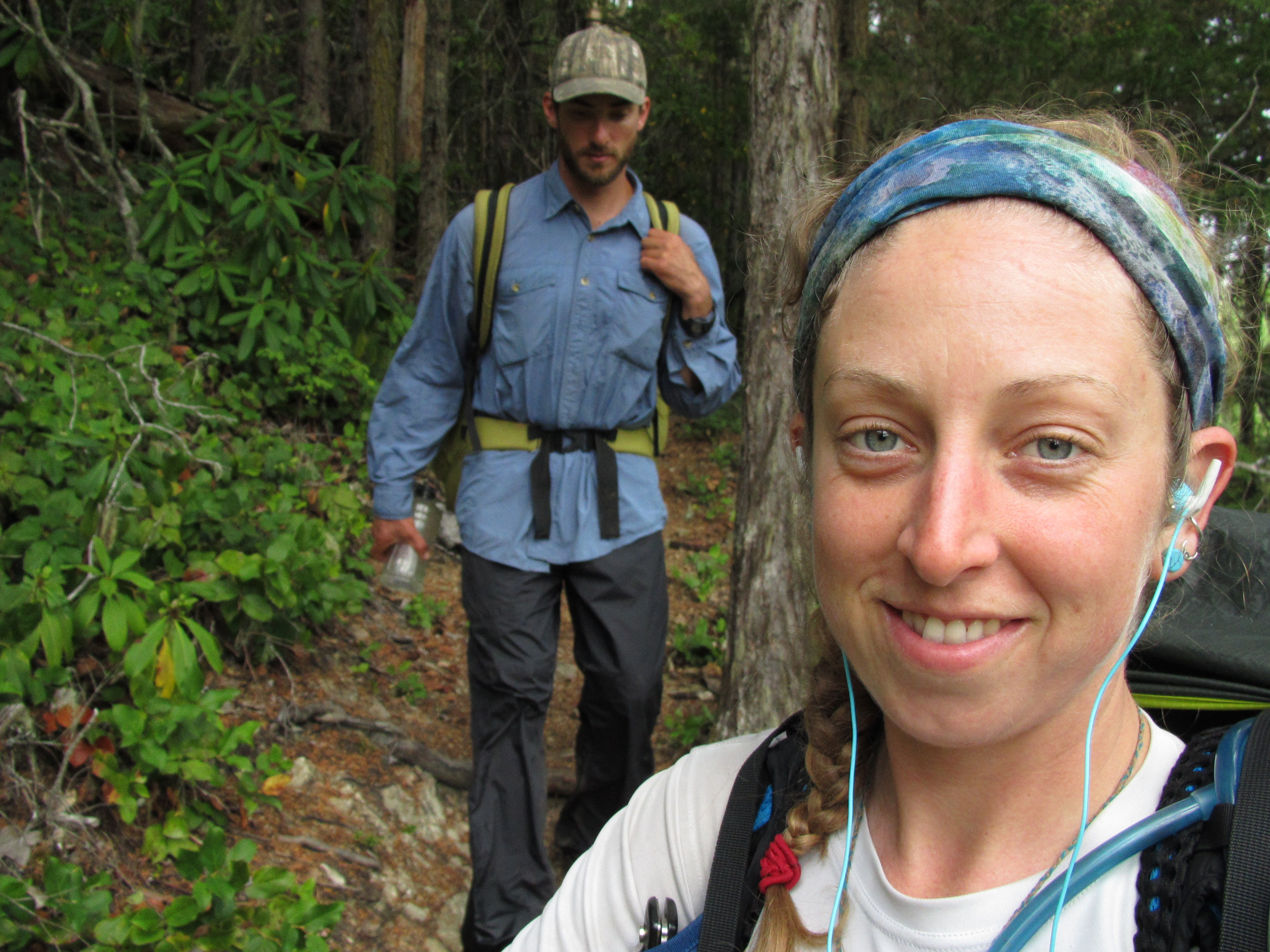
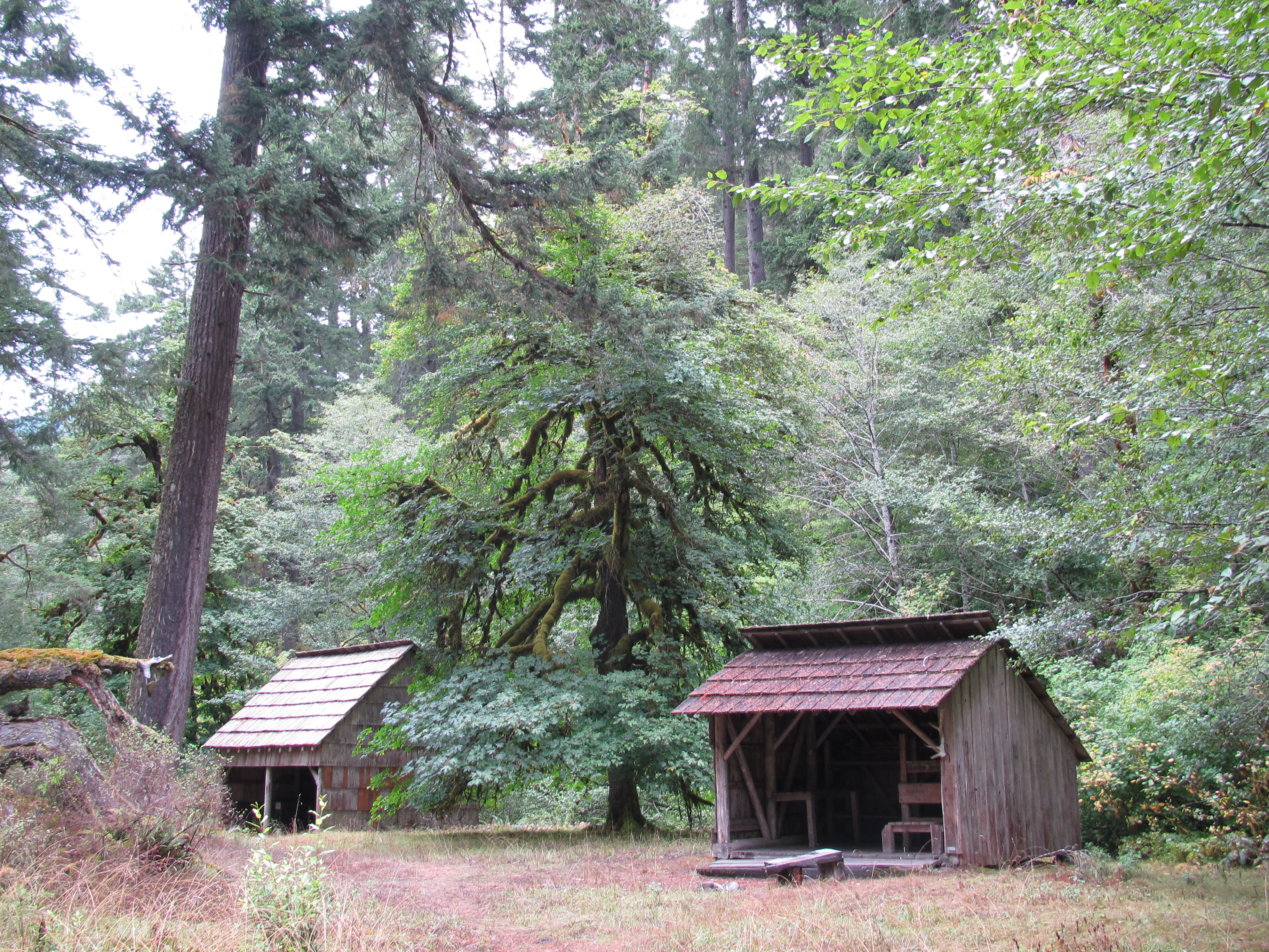
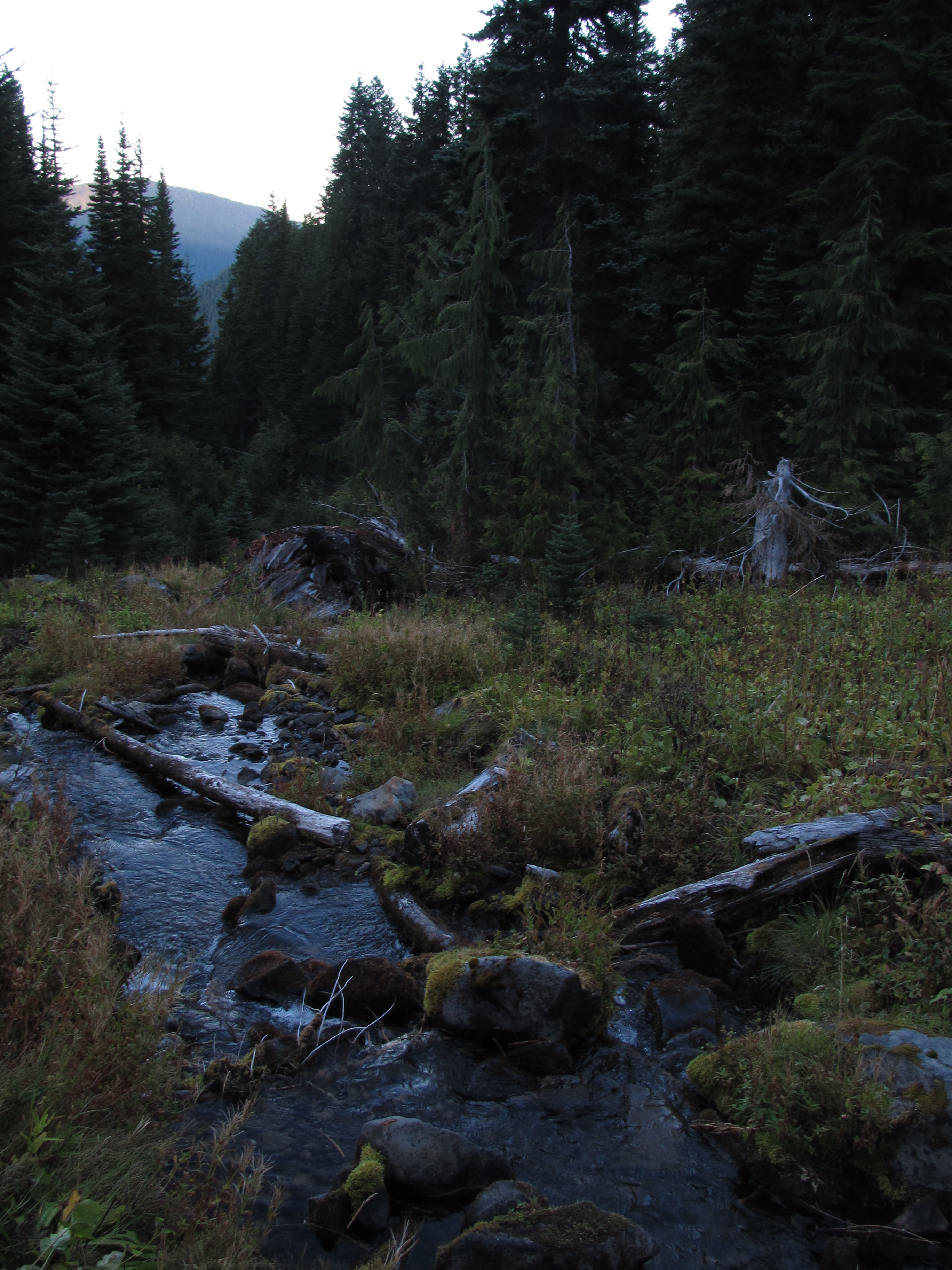
We spent a couple nights in Forks, enjoying the usual luxuries of a town and preparing for the end of our hike, which was too near. When we hitch hiked out, we were picked up by a nice old man, Tom and his dog Tinkerbell. We could sense that he lived only with Tinkerbell and was very happy to have someone to talk to. He was just on his way to his favorite bar to have a cocktail. He told us of his life on the Olympic Peninsula and took us back to the trail. I had a small feeling of sadness when we said goodbye, wishing that I could have given him more than a few minutes of conversation. As we hiked on dirt roads I could feel the ocean in the wind, but I could not yet hear it. The mountain ranges were behind us, there were none to climb – now we are going to find the ocean, our final destination. At one moment I heard a voice of a man calling out to us “Hello.. Hello”. I responded with a questionable “Hello” and he repeated hello to us a few more times, ignoring my response – which just creeped me out so our pace quickened. He was somewhere on another road nearby and had heard us talking. We reached a dead fall blocking the road, and once we passed it I felt safer knowing no cars could access me where I was, and whoever that stranger was, we would never meet.

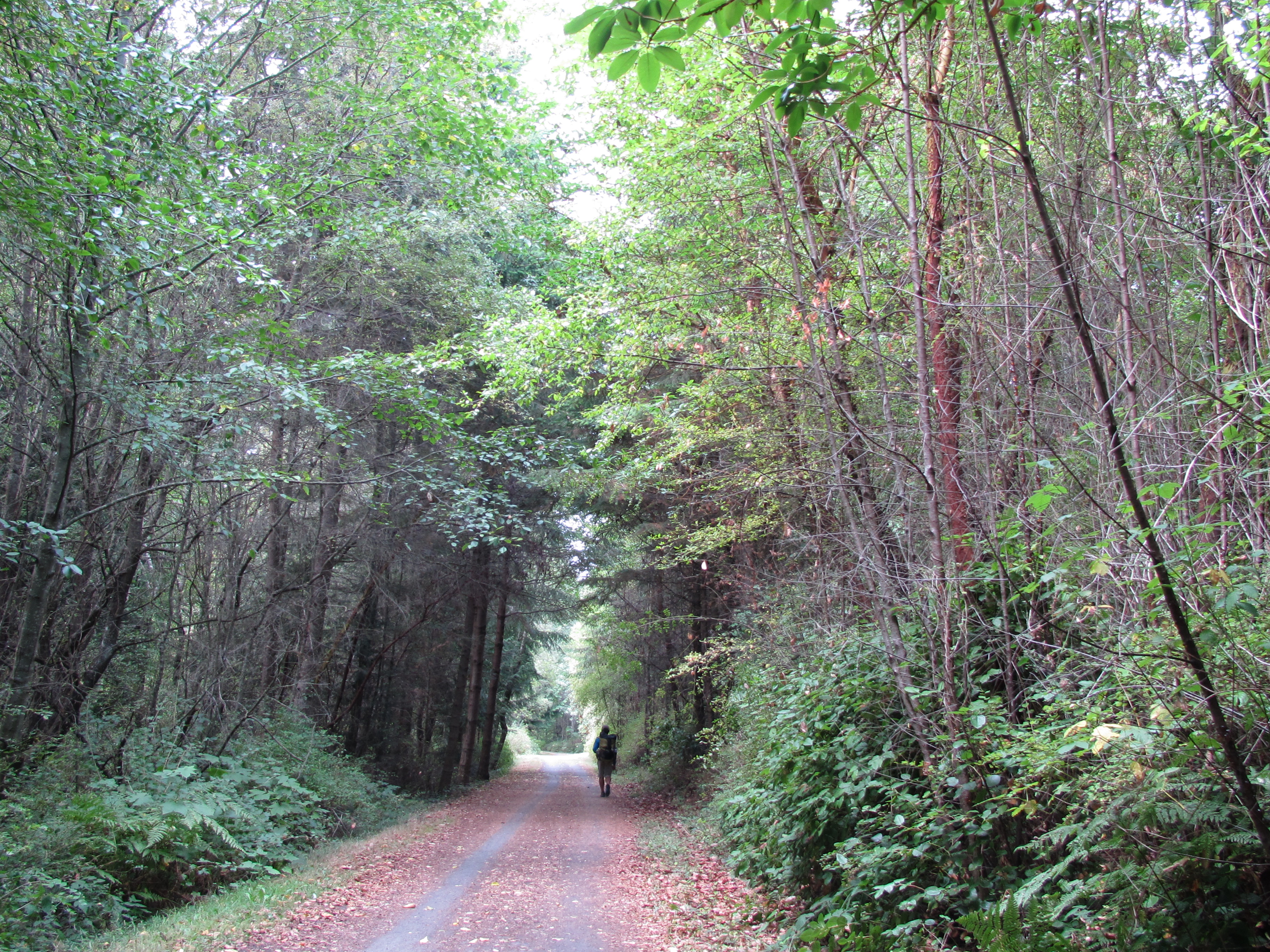
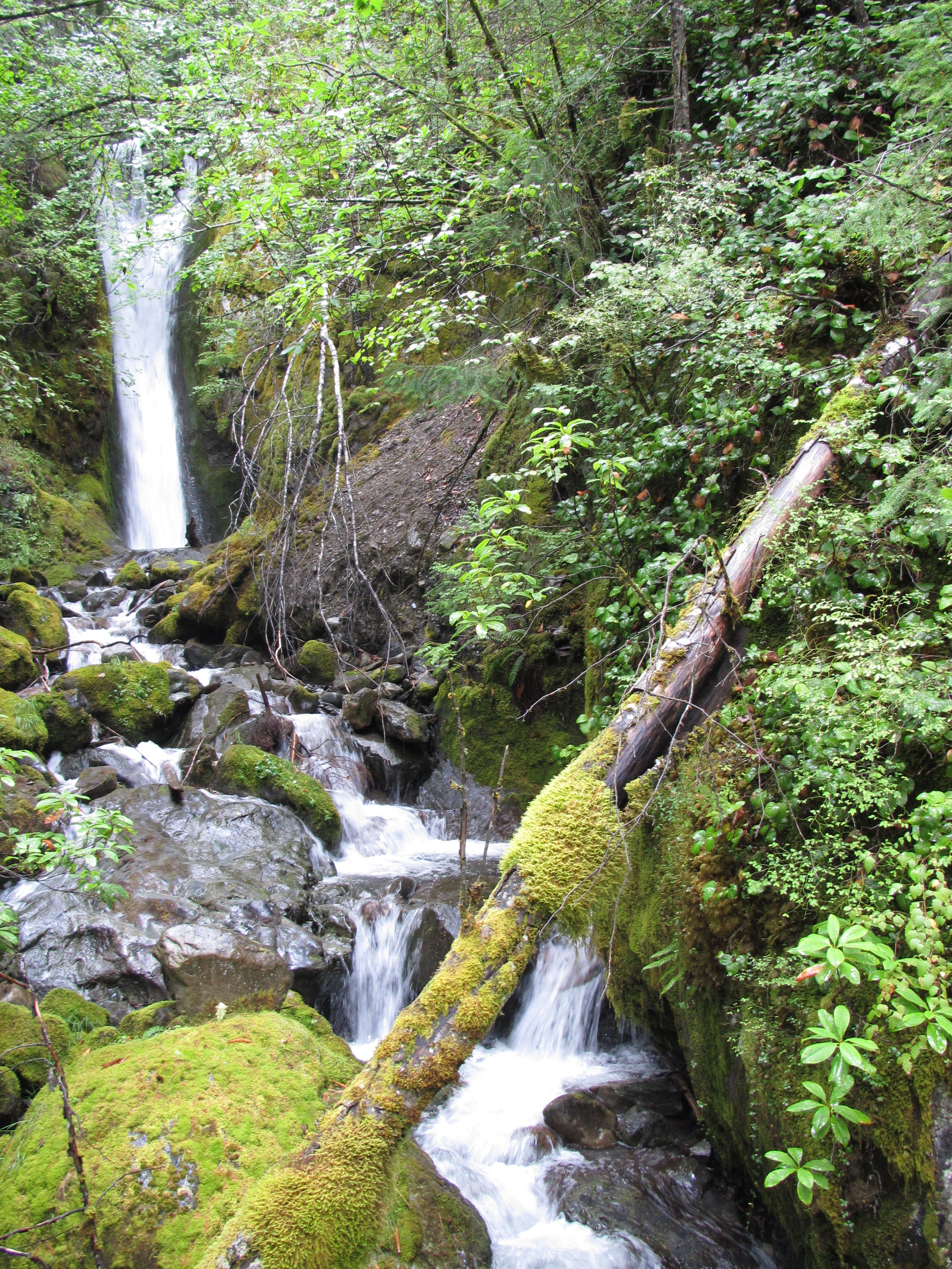
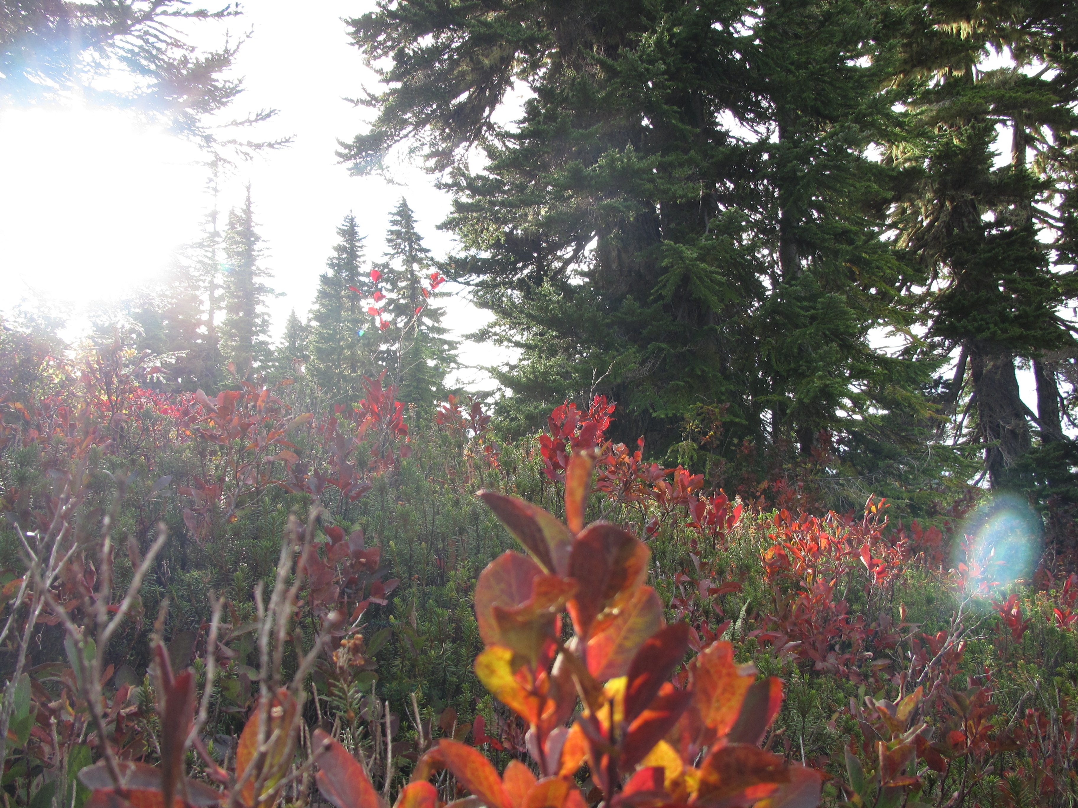
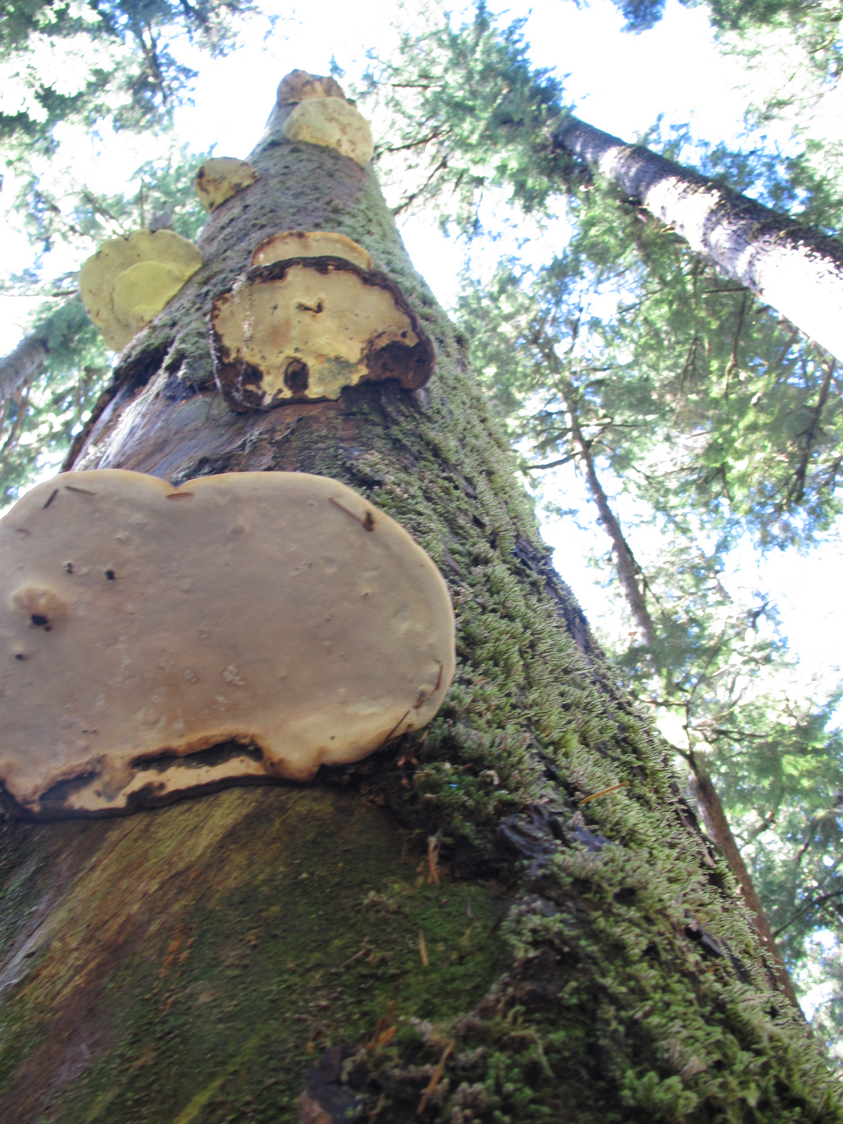
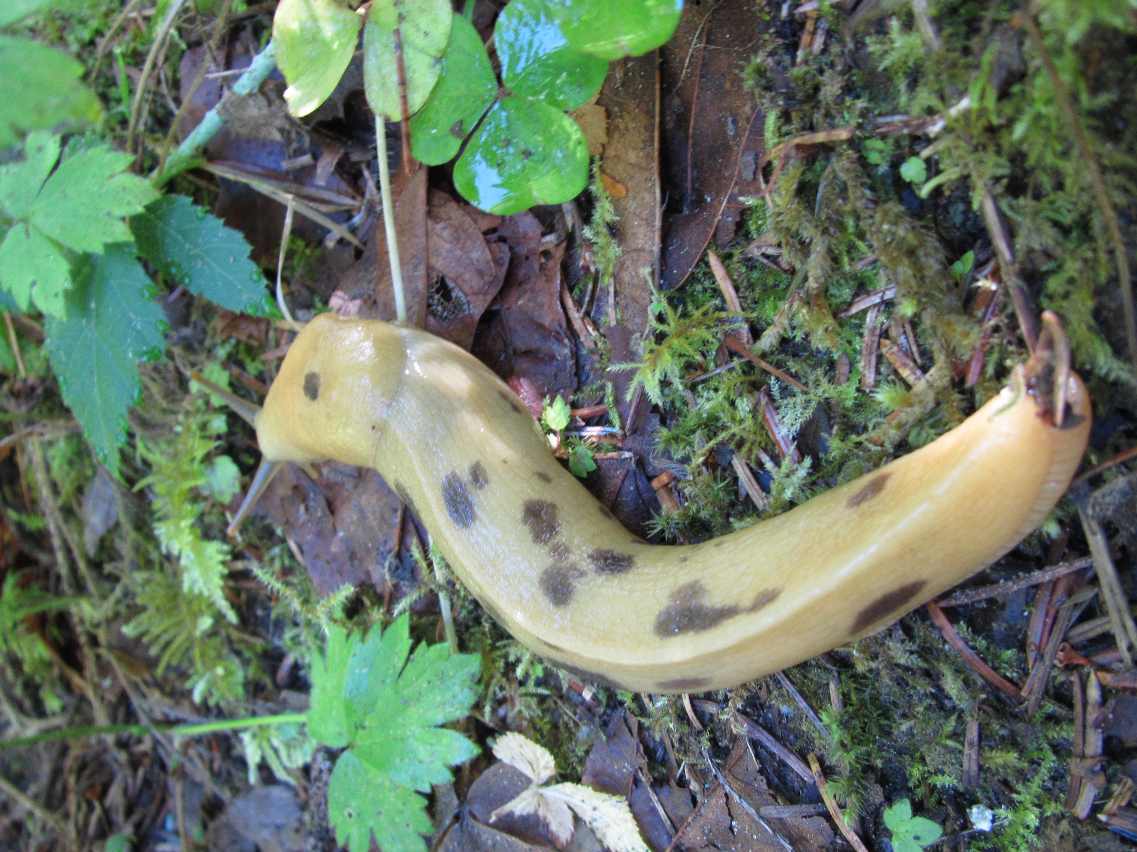
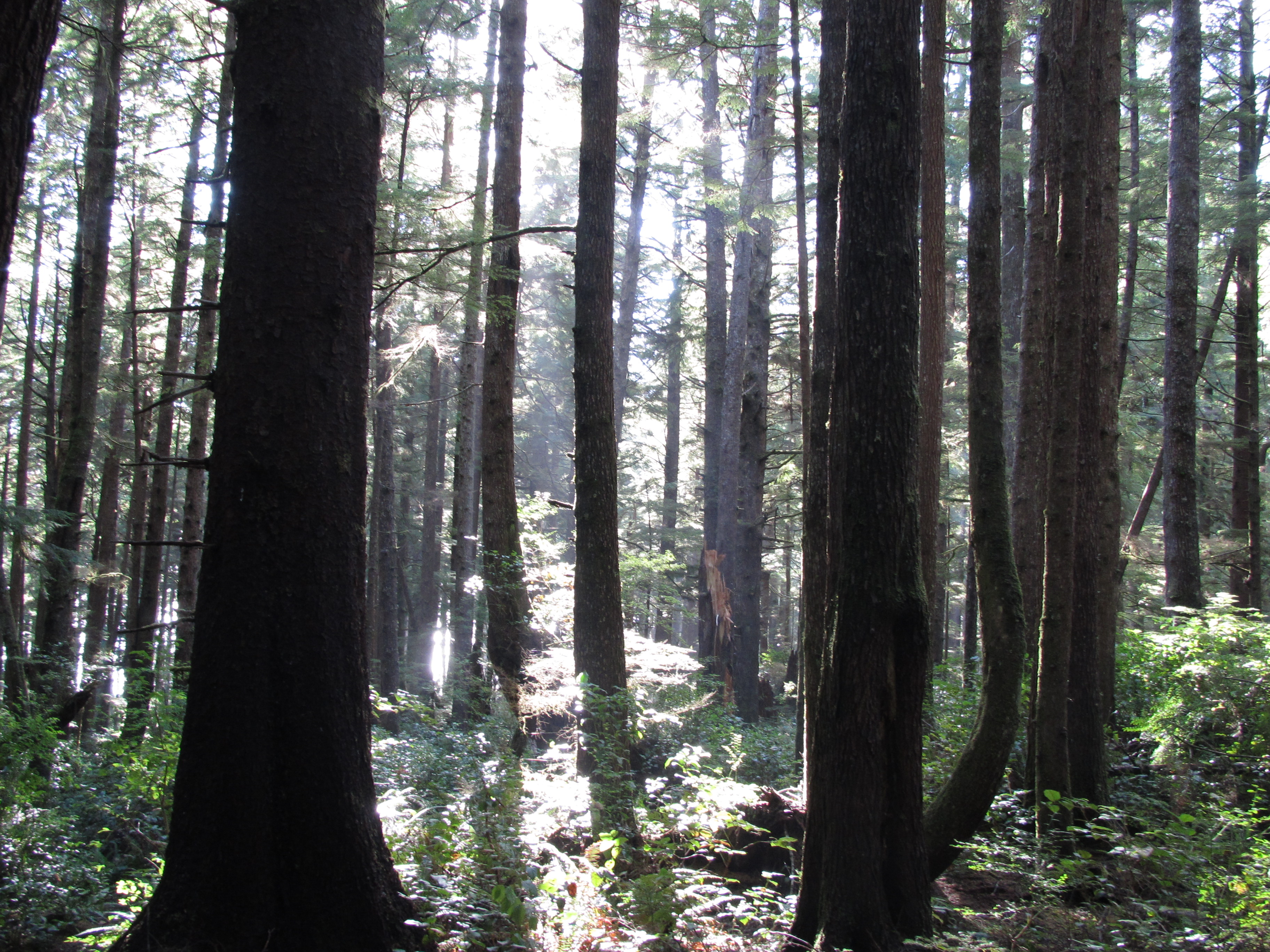
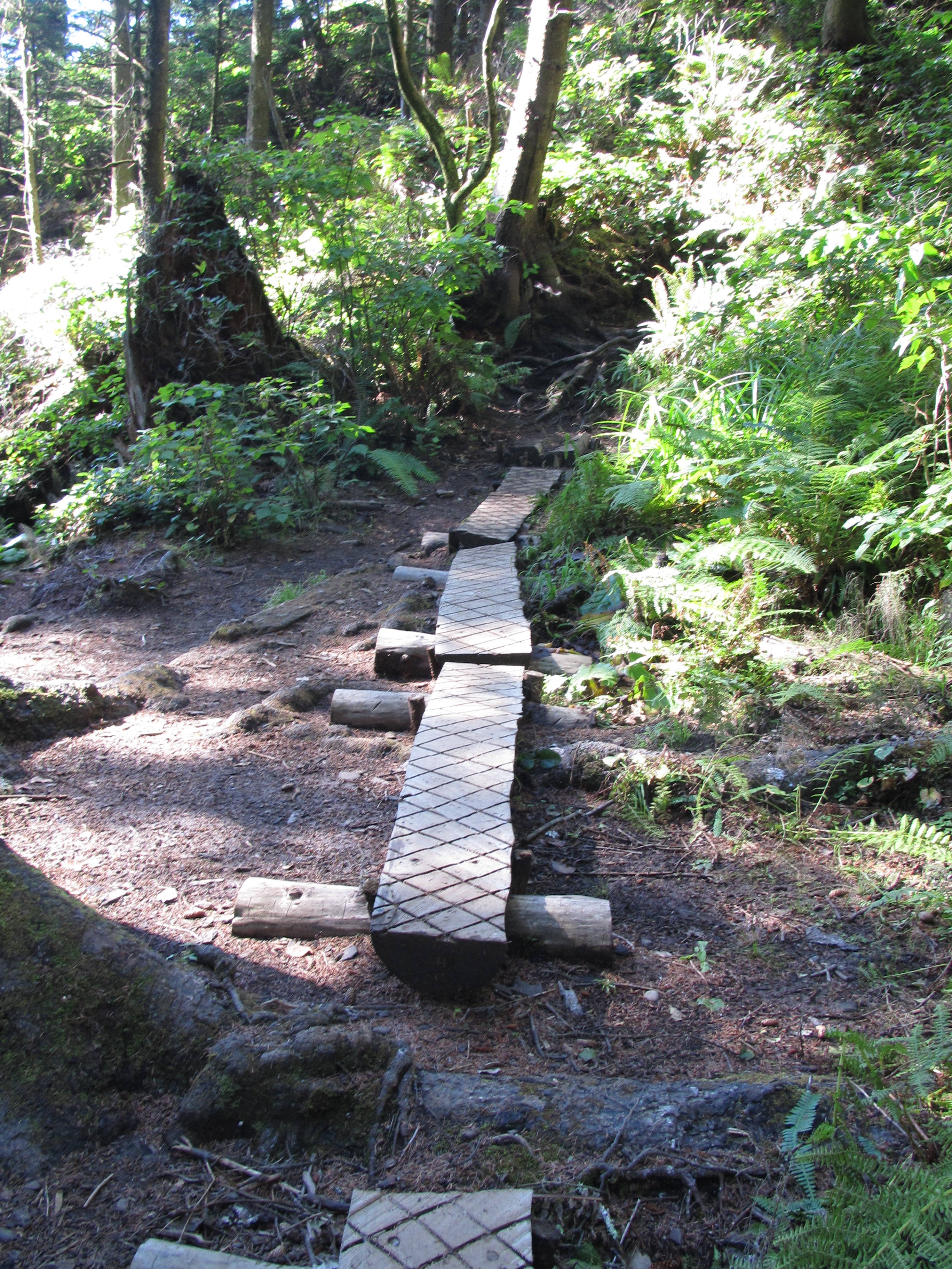
I walked through knee high grass and saw a mosquito hawk fly out, disturbed by my steps. We took a short break here, as I witnessed the end of this mosquito hawk who had flown right into the web of a hungry spider. I felt a little responsible. We hiked to the end of the road together and found a single track trail that would take us to the ocean. Like a portal into another world, we stepped into this enchanted forest, with its mushrooms, banana slugs, giant trees, and beams of light.

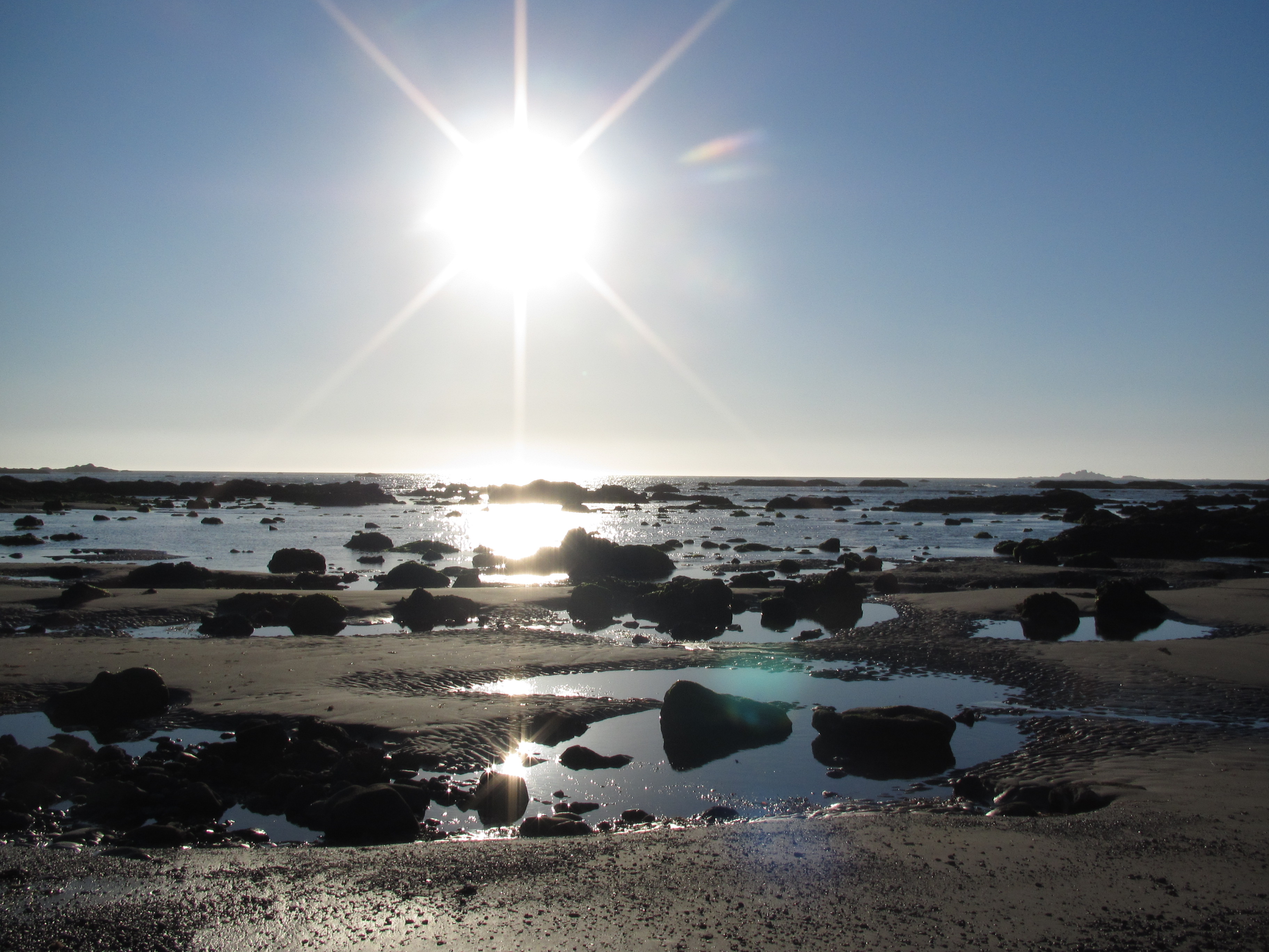
For the first time in almost three months, I heard the waves flowing onto the beach. Soon after I could actually see the sparkles over the water shining through the forest. My first sight of the ocean. We hiked forward, toward this elusive beauty we had traveled so far to reach. The moist brown soil soft beneath my steps. I carefully walked through bushes of ferns and over large roots reaching across the pathway.

Suddenly, like the turning of a page, the soil turned to white sand, and the shady forest turned to bright open light and nothing but ocean and sand existed in front of me. We did it. We walked to the ocean from Montana! We did it! We are here! The Pacific Ocean! We walked here! We did!

IMG_6554IMG_6555IMG_6566

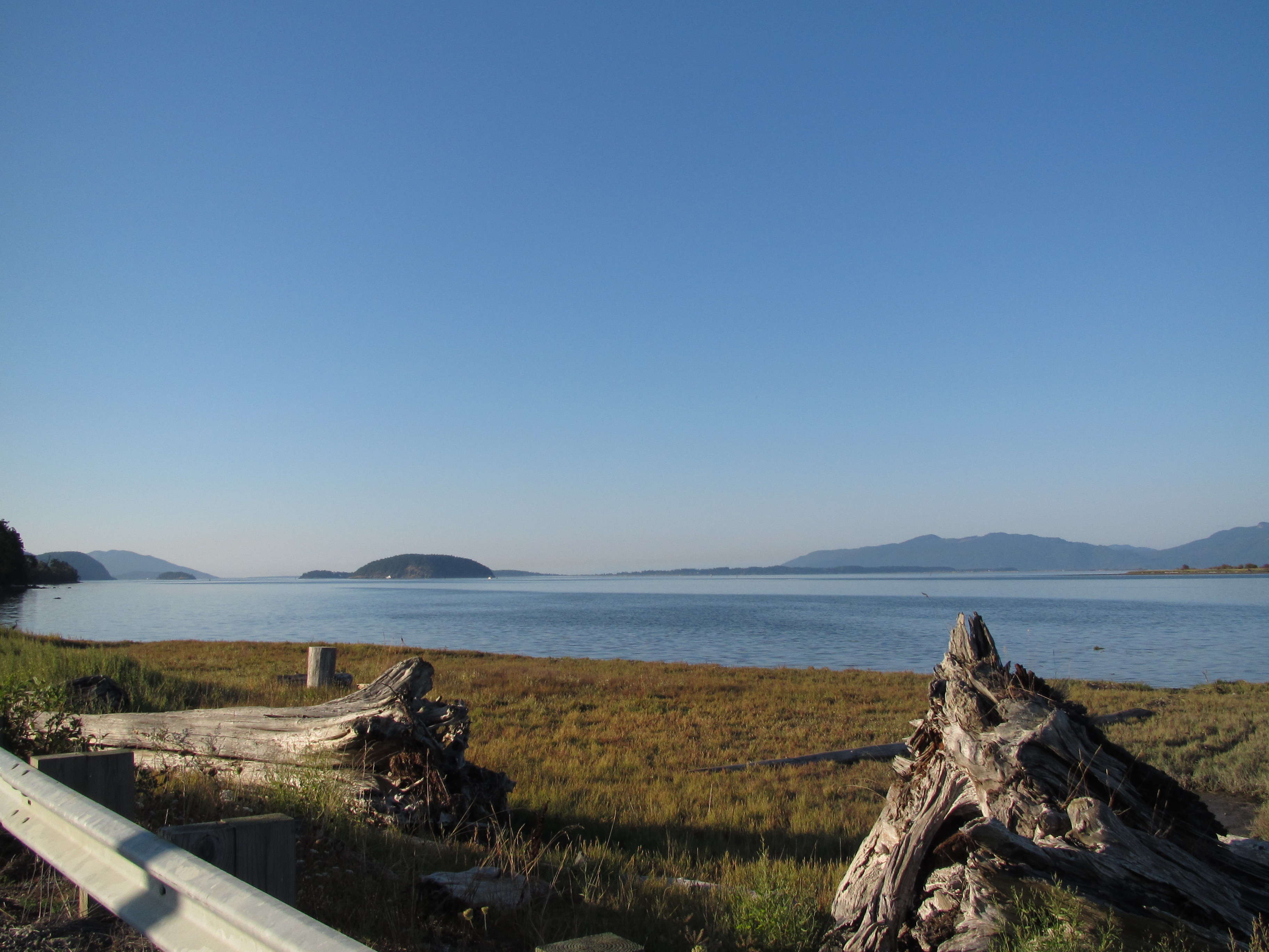
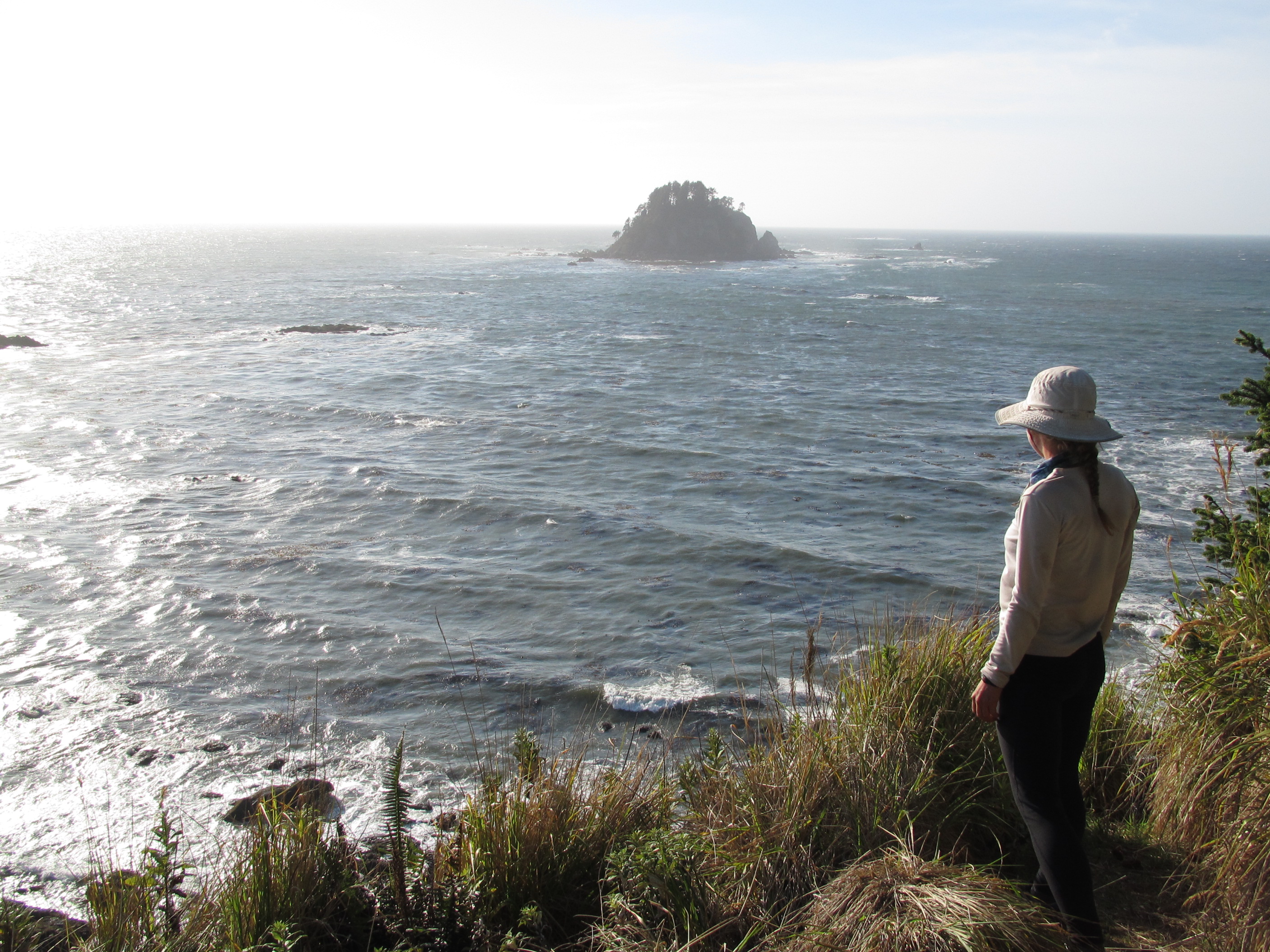
But the journey isn’t over yet. We still have three more days to get to know this ocean a little more intimately than we ever have – even being born and raised San Diegans! We have never known this ocean the way we will come to at our journey’s end. We are going to follow the shoreline to our final destination at Cape Alava, the end of the Pacific Northwest Trail, and the furthest western point of the Continental United States.

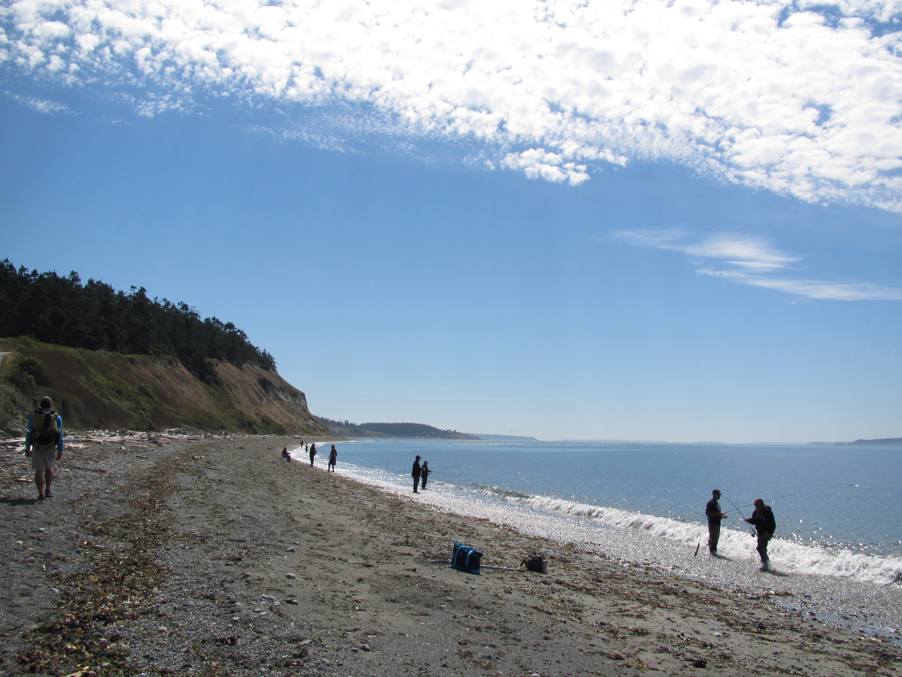
There weren’t any volleyball courts, no bikini-clad teens, no boardwalk, and no dog poop! This was a wild place. Coming from a city with densely populated beaches, this is uncharted territory. This was a real beach – this is what beaches used to look like before people built resorts on them and roads to them. This is wilderness.

IMG_6567IMG_6570IMG_6573

The tides are something I never tried to understand, but walking along the ocean for a few days will get you accustomed. I carried a small tide chart, but we barely followed them intentionally. Our habits made us lucky each day, figuring we did not have a lot of miles to travel, we would sleep in and enjoy the morning. Leaving camp around ten a.m. we were already on a wide beach, by the time we came to a headland, the tide was just coming to it’s highest – and guess what, it’s lunchtime! Our long two to three hour breaks would send us on our walk as the tide went back down.

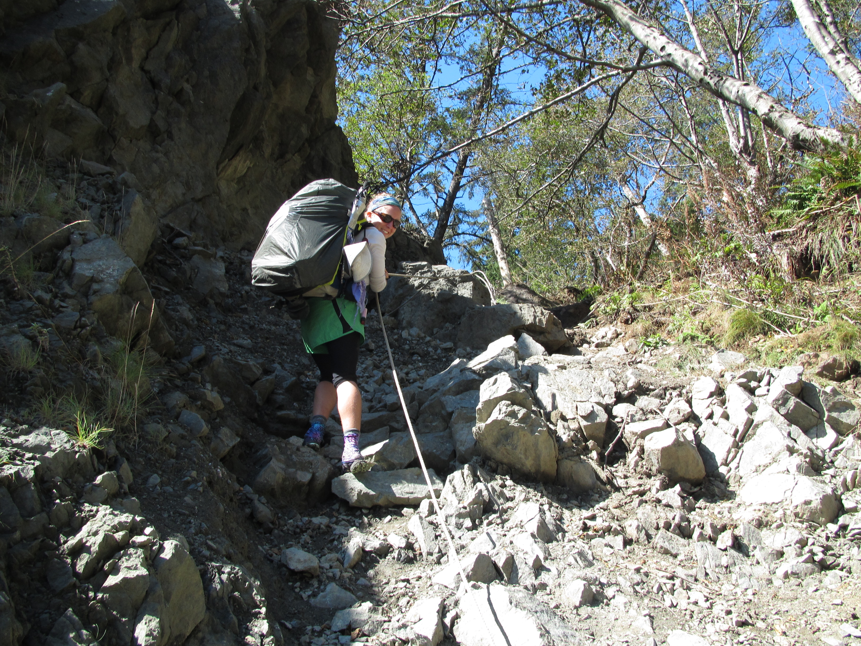
In some places, we could only pass a headland at low tide, so often times we had to take the high route up and over the capes. Climbing ropes and ladders, and traipsing through what had become familiar rain forest. The walking was easy along the beach, and the climbs were exhilarating.

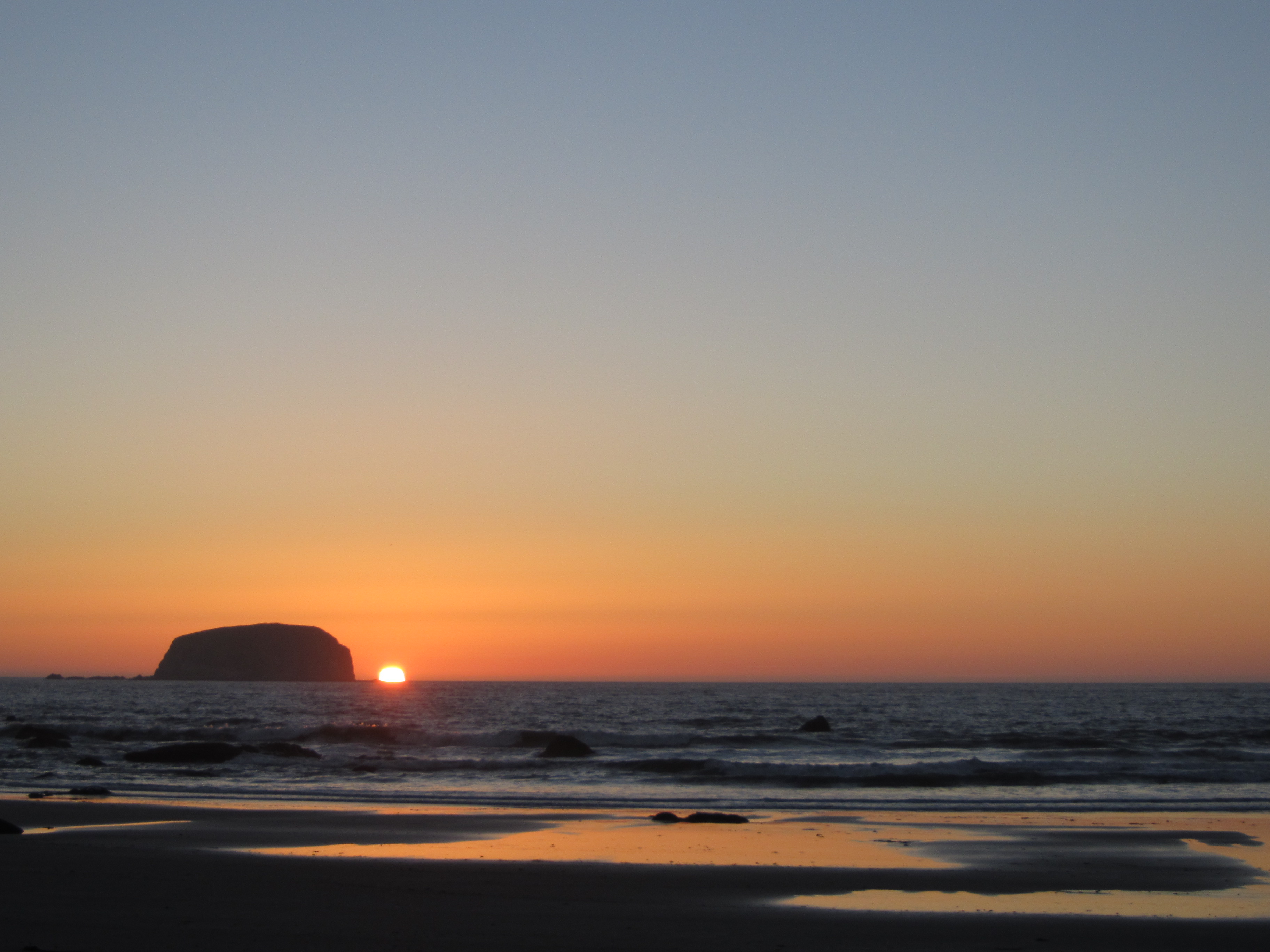
Each day we felt the sun moving over us from the east and finishing it’s show on the horizon to the west. I have always made it a point to watch sun sets whenever possible, and by the time we reached this big beautiful sea, I was deprived. We arrived to our campsites by the setting of the sun, and would eat our dinners on the beach to say our thanks to such a glorious day.

IMG_6578IMG_6583IMG_6591IMG_6597IMG_6598IMG_6601IMG_6603

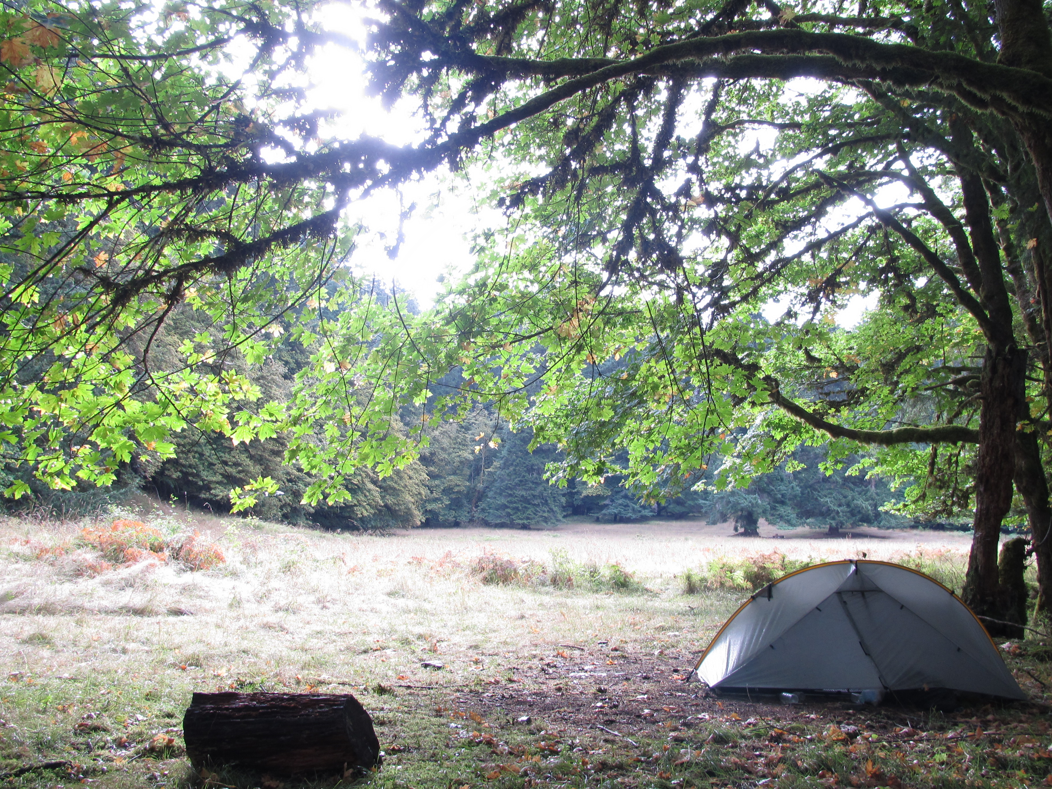
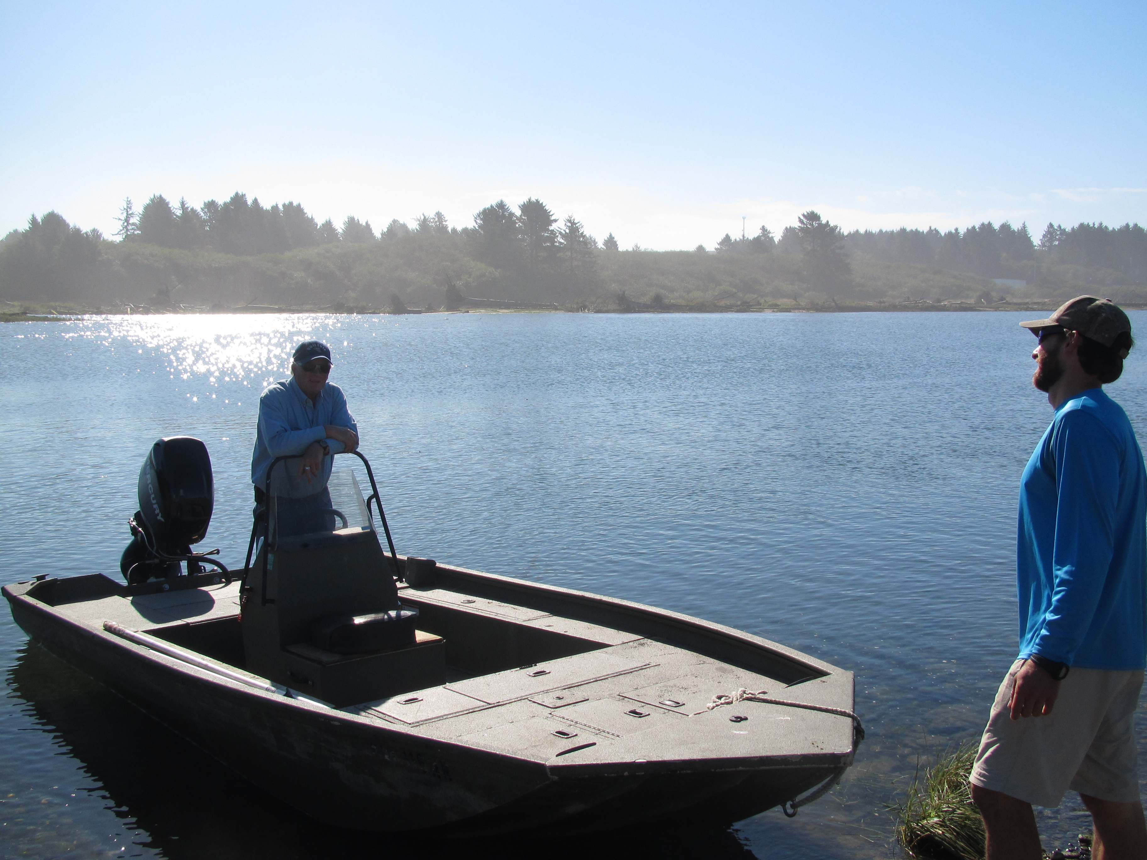
Roadwalks. And you thought they were over! Nope. We had to walk a couple of miles into the town of La Push along a sketchy road. We munched on snacks at their convenient store and then marched through town to the Marina where we hoped to find a local fisherman to take us across the river where we could continue our journey North to Cape Alava. We were unlucky enough to arrive their after the Marina had closed and no one was around. Ted and I ate a meal of fish and rice for unreasonable prices at the restaurant next door. Then headed down to the beach where we would camp, hoping to find a ride by morning. We tucked our tent as far away from the ocean as we could, noting how far up the tide line went, and we managed to stay within just a few feet of the water at it’s highest.

In the morning we headed back to the Marina and met a nice man who happily took us across the water. He filled our heads with history and Native lore before sending us off onto the sea stack and drift wood covered beaches.

IMG_6606IMG_6618IMG_6625IMG_6627

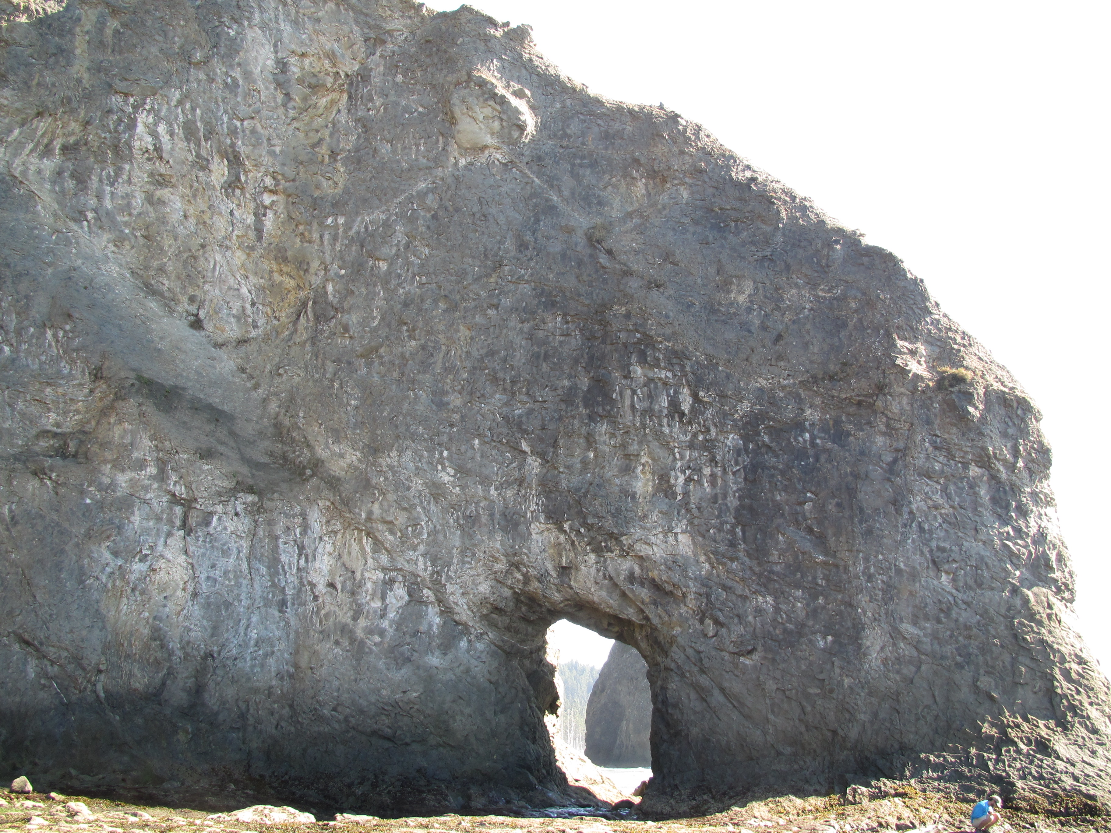
We ate our lunch at a rock fondly known as “Hole in the wall”. It was covered in waves when we arrived, but we stayed so long that the tide completely went out and like children discovering a new land, we went in. We stepped lightly as we moved over tide pools full of anemones and crabs, enjoying the deep crashing of the ocean like the heartbeat of the earth, beating at my feet and caressing my toes.

IMG_6636IMG_6648IMG_6650

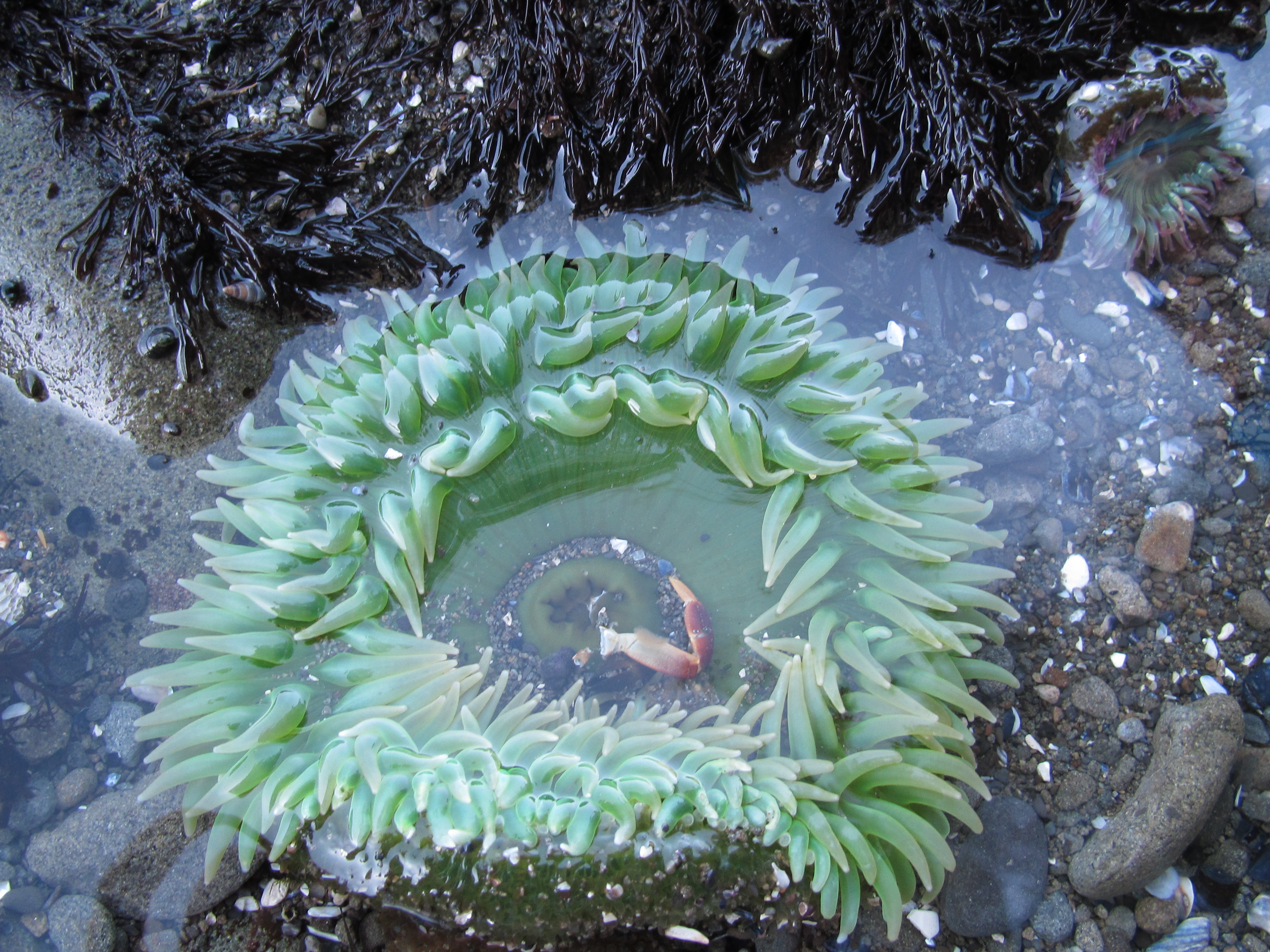
Little did we know how much more tide pools we would have to travel over. It took us all day to travel eight miles, the rocks, capes, and algae made for a slow-going day. But not an unrewarding one.. no ankles were twisted and no heads were bruised. We were headed toward an official camping area when we found a magically unofficial one about half a mile early. The beach was huge and the sea stacks invited us for sun set. Our campsite was in the forest on the bluff. We had to climb a rope about thirty feet up to reach a small flat space with a driftwood bench, a fire ring, and a tent space – not to mention a massive mushroom and a view of the sun set. We had this spot all to ourselves, and we could do nothing but ravish in it’s perfection.

Once the sun had set, we seemed to be thinking the same thing, when I said “I’m going for a walk, want to come?” We climbed down our rope and strolled barefoot under the clear black sky dotted with billions of stars and a bright milky way galaxy smiling down at us. The ocean in it’s ever-flowing sounds, wet sand beneath my naked toes, Ted by my side, and peace in my heart. We walked.

The next morning was our last full day of thru-hiking the PNT and we knew it. We enjoyed every last moment at our campsite, the literal best campsite of the entire summer. And when it was time to go, our feet took us slowly along the beaches and tide pools to our final camp site on the beach. Goodnight, said the sun. Tomorrow is our last day.

IMG_6651IMG_6656IMG_6659IMG_6660IMG_6661IMG_6666IMG_6670IMG_6672IMG_6678

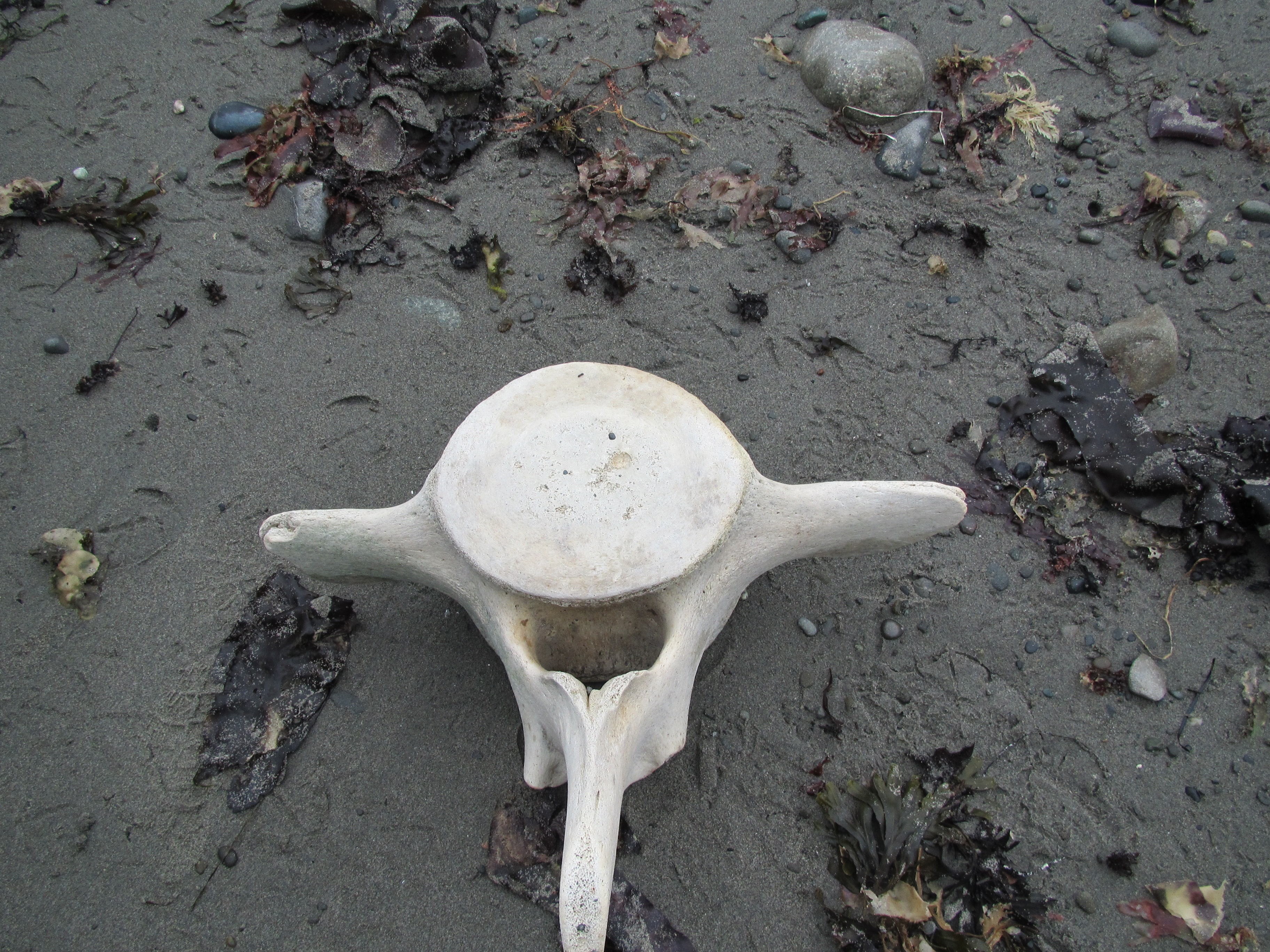
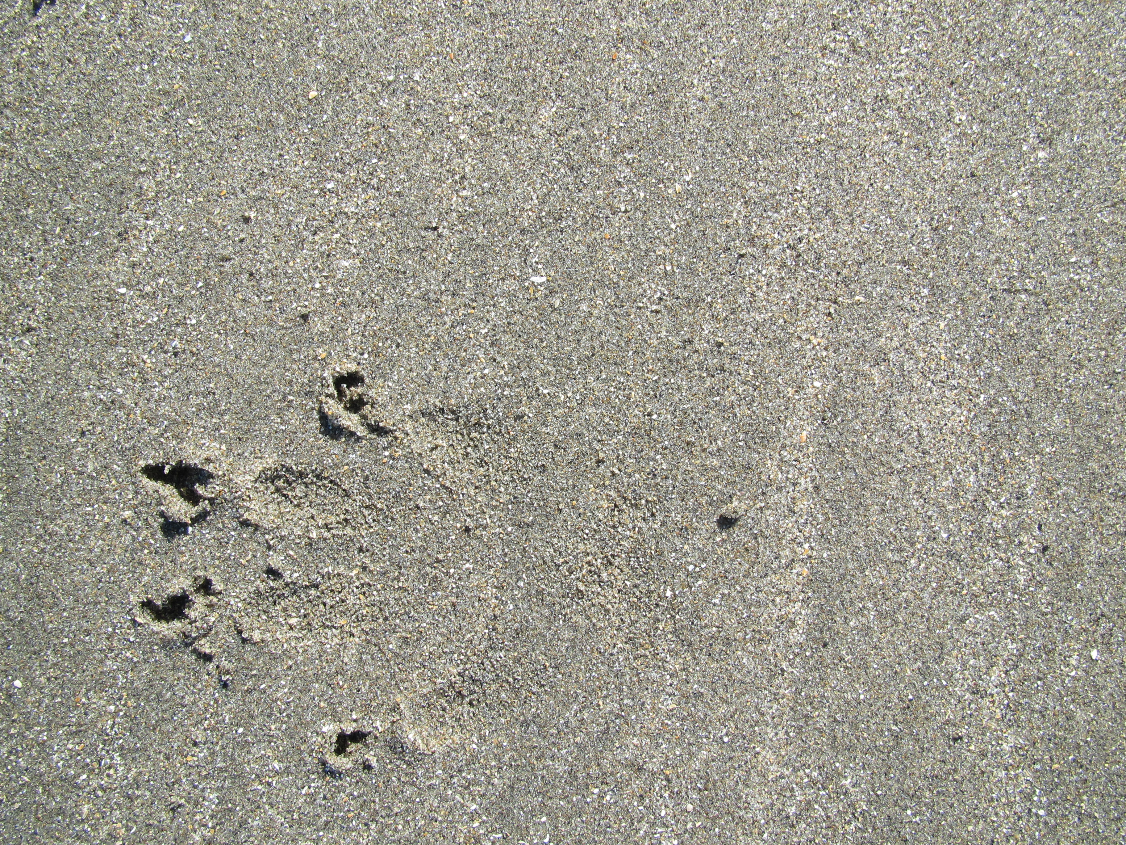
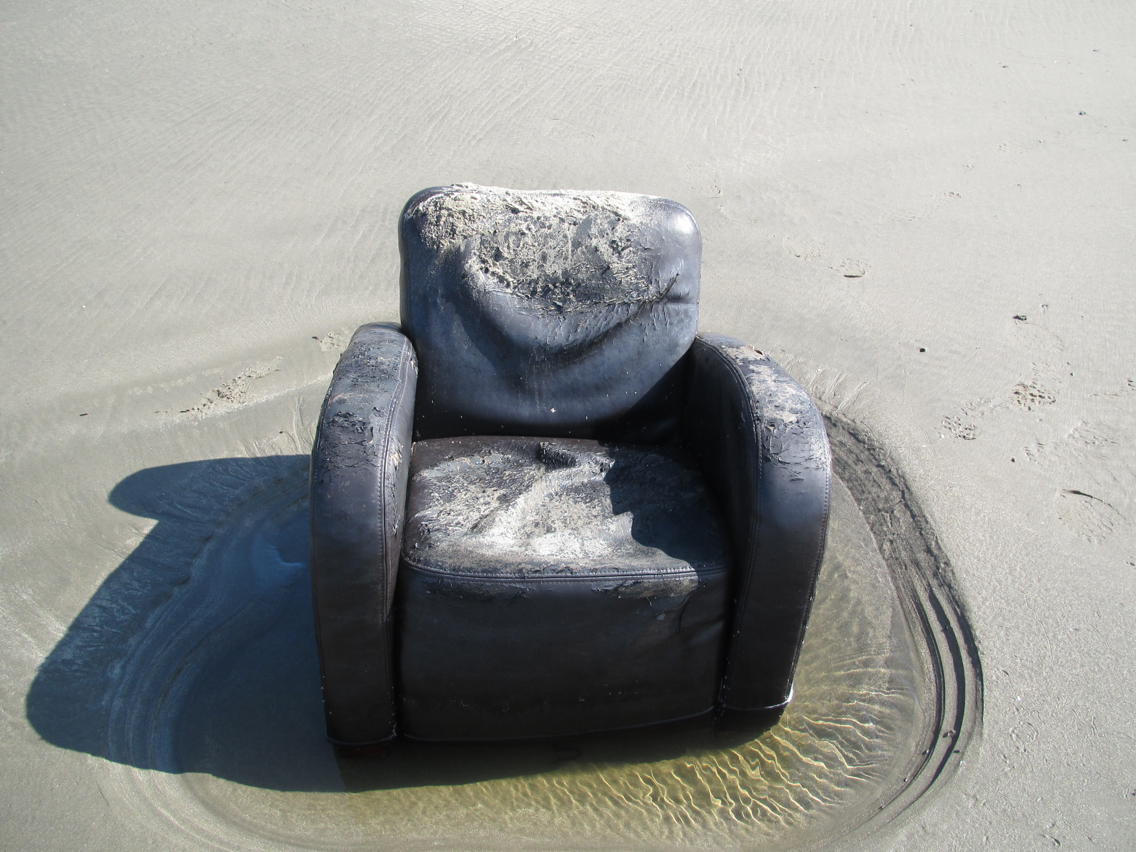
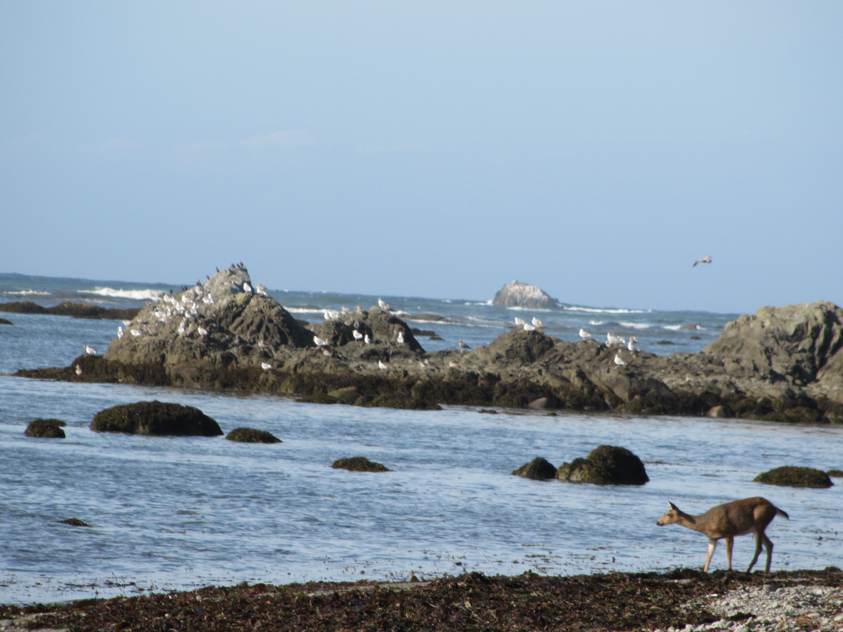
On the final day of our hike, we began to see day hikers. We also saw deer and found prints of coyotes in the sand. There was a lot of junk washed ashore, mostly from Japan. Plastic bottles written in Japanese is how I figured that out. A lot of plastic buoy’s, nets, crates, and all sorts of junk – as well as the huge bones of whales. Who threw a recliner into the ocean?

IMG_6681IMG_6682

Since the past few days had been traveled at unbelievably slow paces, we figured today would be no different. So we hustled. My parents were meeting us at the end of the trail and I had told them we would be there in the late afternoon. More and more people came into view and a family approached us to ask us about some petroglyphs at Wedding Rocks. I stumbled. Had we passed Wedding Rocks without seeing them? I looked around and I saw an island, one that I recognized. It hit me. We had passed Wedding Rocks two miles ago, and suddenly we were at the western terminus of the Pacific Northwest Trail. Our hike was over. How did that happen so fast?? It was unexpected and hit me like a train. Suddenly we had nowhere to walk. Our hike was over.

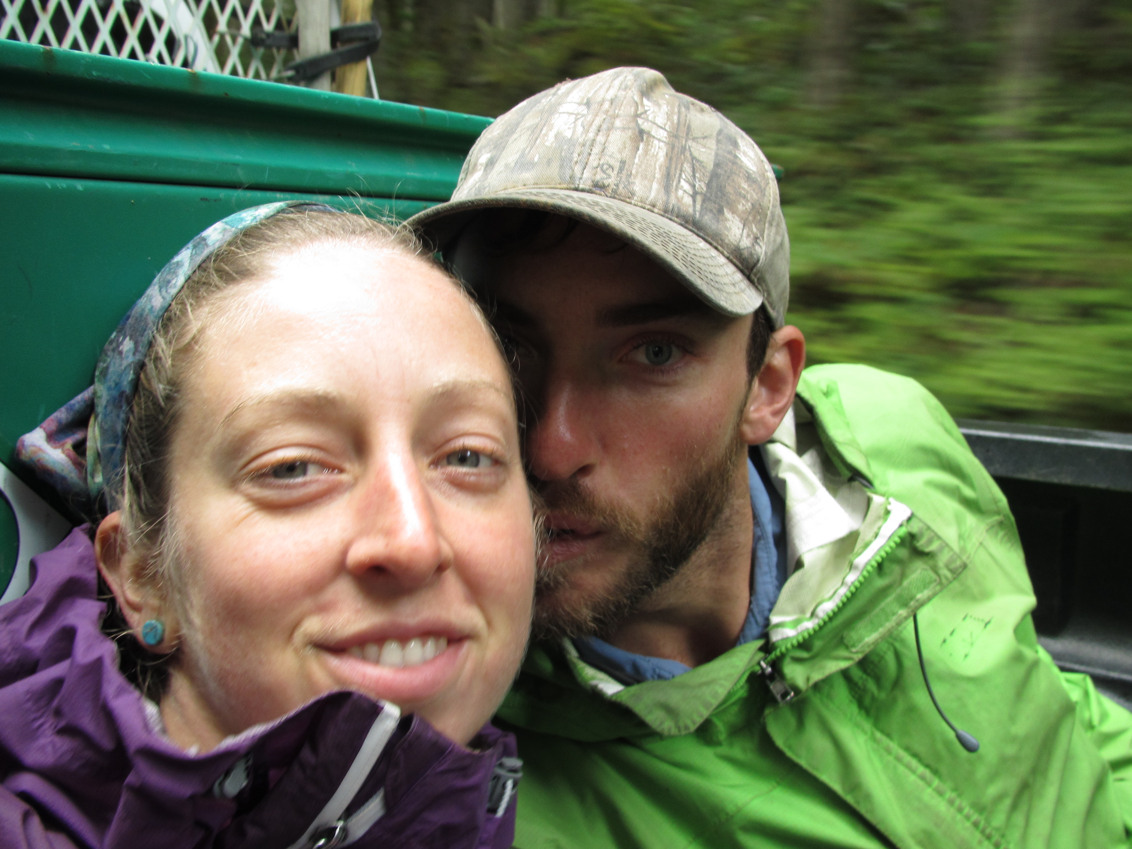
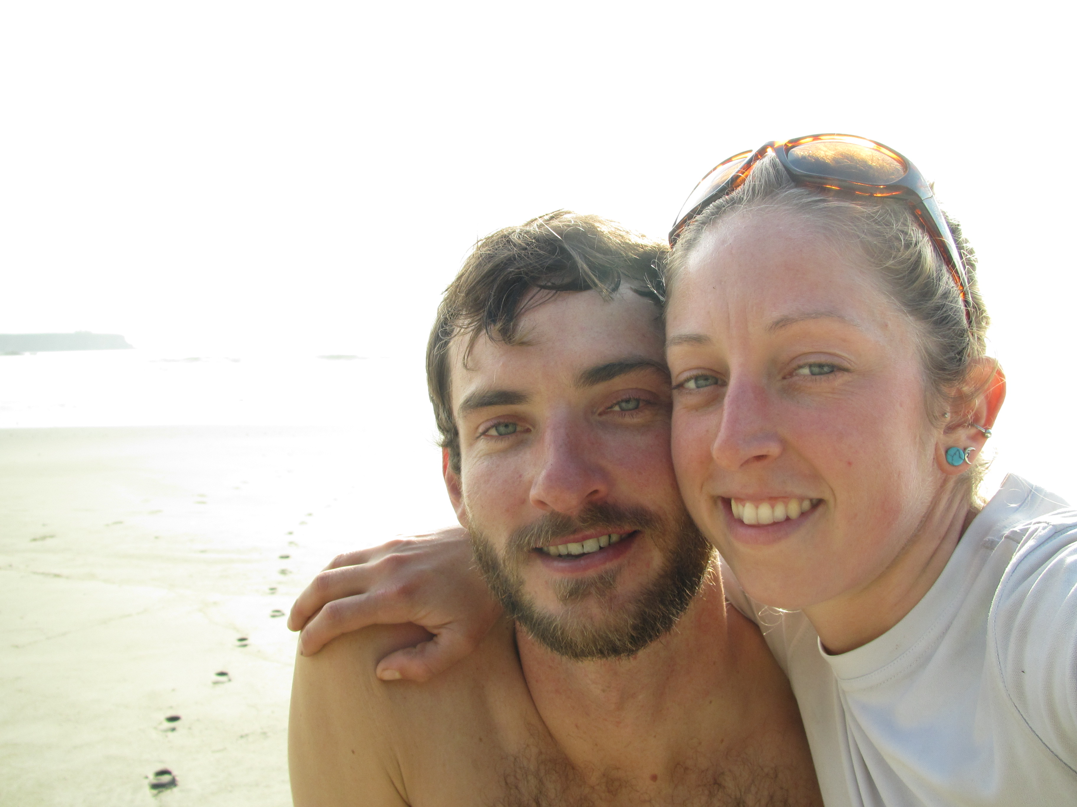
Not before a celebration with hot totties! We had packed in a bottle of Jack Daniels, some raw local honey, and a fresh lemon for this special occasion. We spent three hours cheersing, lying in the sand, sleeping, laughing and sharing a few tears. We did it. We are thru hikers.

But wait, we had such a long break that the tide went down again and there was land access to the ACTUAL furthest western point. So we stashed our packs and ran out along this strip. We circled the island before running up it’s practically vertical slopes. Nothing up there but pine tree’s and soft grass. We looked out over the ocean in great reverence for our successful journey through the Pacific Northwest. What an amazing walk!

IMG_6685IMG_6690IMG_6694

IMG_6703

Our journey was 1,200 miles long which took us just under three months to complete, end to end from Glacier National Park all the way to the Pacific Ocean at Cape Alava.  Words can never express the challenges, the beauty, and the greatness of the personal rewards we reaped on our walk.


Thank you for following our journey! Stay tuned for my personal solo bicycle ride home from the end of the trail all the way down the West Coast and to my parents door in San Diego, California.


Thru The Cities and Into The Wild

While I was waiting for my clothes to dry in the laundromat in the old, run-down town of Concrete, I was given a handful of change by a young man with a toothy smile – clearly he thought I was homeless and in need. He had no idea just how fortunate I was to be so dirty, smelly, and vibrant from the true adventure I was on. He had no idea that I had voluntarily walked a thousand miles just to be there in that moment, every day, with all I could carry on my back, for the sheer joy of living life authentically in the most beautiful way I could think of. I took the change, because I could buy a soda with it. Root beer is my favorite, and I won’t turn down a cold soda on a long walk.

We walked out of town after a relaxing zero day, which marked the beginning of an urban hike. The path out of Concrete was an old railroad turned into a community bike/running path, which led us all the way into Sedro-Wooley. We saw locals using the trail with their kids, some on horseback, and solo cyclists and runners. The views were pleasant under the forest that engulfed the trail and the large river that flowed alongside it for some miles. The trail was so easy that we left at two o’clock in the afternoon, and traveled over twenty miles by the time darkness fell. We made it to Sedro-Wooley a little beat from the pavement, but eager to get through this urban section. We had no option but to stay in another hotel.

IMG_6332 IMG_6336

We walked out of Sedro-Wooley on the rail trail, but it petered out after just a mile or two, and our path became the railroad. It was probably the worst walking I had ever done. The rocks used for railroads slip under your feet in each step and the sun was burning down on us, no views to speak of, and anxiety because we were probably breaking the law and we didn’t feel very safe being on the outskirts of big towns. I was struggling to stay positive until we came upon a funny little mobile coffee shop that was used by railroad workers. It was called “Perfect Ten” and had a naive eighteen year old girl working their in her uniform – a stringy bikini. We watched as a creepy old man lingered at her window for too long. We ordered drinks there and took a break under the shade of a bushy tree for a while. A few more miles and we reached our first sight of salt water just outside the town of Anacortes. This was a very special milestone for us. Although the walk was on a road, it was very pleasant compared to the railroad, and not many cars were passing by. Ted and I enjoyed each others company as we usually do, walking, laughing, and talking. We crossed an old trestle that was converted into a walking path that lead us into Anacortes as darkness fell. We could see the oil refineries on the other side of the water, all the lights reflecting on the water was strangely beautiful.

IMG_6338 IMG_6340
IMG_6348 IMG_6360

Anacortes was a busy town, and I’ll leave it at that. We walked through some farmlands, residential areas, and along beaches of the Puget Sound where people were fishing. For me, the San Juan Islands were just a bunch of traffic, heat, roads, and just all around not that great. Ted and I were eager to get through it and into the Olympic Mountains. We are wilderness lovers, we walk to be in the wild – not in cities. The road walks were difficult for me. I felt like thousands of eyes were staring me down, judging me, but not knowing anything about the journey I was on. I experienced people at convenience stores avoiding eye contact with me because they thought I was homeless. These people were just normal looking people – who could have been my teacher, my friend, my coworker – but since I was dirty, they didn’t see me as a person who deserved to be acknowledged. This hurt me, as I imagine it hurts real homeless people every day who are treated like they don’t exist.

IMG_6371 IMG_6372

Finally, a moment we were waiting for. We reached the ferry that would take us across the water to Port Townsend, our last town before going back into the mountains!

IMG_6377

We stayed in yet another hotel in Port Townsend which was a fancy little town on the water with a lovely food co-op with all kinds of wonderful things for sale. Ted and I walked to the co-op from our room and brought back bags full of kale, bananas, locally made smoothies, baked goods, and of course chocolate. We have trail-named ourselves “Team Late-Checkout”, because it’s true – there hasn’t been one single hotel where we didn’t dial 0 and ask for a late check out. How can we? We have a bed, a toilet, and a TV. That costs a lot of money, you know. Better use it up for all it’s worth!!

When we finally rolled out the door 10 minutes later than late check out, we realized it was time to eat more food. It’s always so hard to get the ball rolling… By three O’clock we were back on the “trail” which was the road, and then another “rail-trail” which lead to a crappy pipeline “trail”, which then lead to highway 101. Once we finally began heading west through the woods again we felt like we were trespassing but weren’t really sure. The “trail” was another pipeline that was right up against several backyards and just covered in berry bushes that pulled at me all along the way until we reached a forest road. The road was not on my GPS or the maps, but we both had a good sense of where we should be headed, so we walked on down the road and hoped it would lead to where we needed to be. The road did eventually take us back onto our maps but we weren’t able to get out of this web of roads in the Olympic National Forest before dark, so we had to find a flat spot to sleep that also had water. In my experience, a nice campsite is always just 20 minutes farther than the point where you feel like you’ve already gone too far, so I kept prodding Ted, “just a little farther”. Sure enough we found a creek under the road with a little flat spot on top of some cushy earth beneath moss-covered pine tree’s, hidden from sight of the road. We did our normal camp chores, cooking dinner, filtering water. I put up the tent while Ted prepared our food hang, as we do each night.

IMG_6381 IMG_6385 IMG_6387

The next morning was moist and foggy as we walked along the dirt roads. A truck drove by and stopped to ask us if we were okay. He was astonished to find that we had every intention on being where we were, and that we weren’t interested in a ride. As we followed tracks on my GPS, notes from our guide book, and our maps – we became aware that we were approaching a short section of bushwhacking. The route took us down into a creek bed and over a small ridge. I enjoyed the intimacy of bushwhacking. I had to touch the trees as I made my way through the forest, stepping gently on the mossy earth as it gave softly beneath my feet. Hiking off trail is very slow and deliberate, especially in the forest when you always have to be paying attention to which direction you are traveling. Since you cannot see your destination, it is easy to get off track. You know it is there – east, west, south or north. You just have to keep moving in that general direction – making your way around trees, ravines, and rocks. These cross-country sections of the PNT always keep the days interesting and exciting by challenging our skills and offering more sensations and connection to the land.
IMG_6390 IMG_6403

After the bushwhack and a little more forest road walking, we came across a trail-head placed randomly in the middle of the woods which led us to the top of a mountain. It was cold and blustery, but we were hungry when we got to the top, so we found a protected spot among the trees sat down and ate some food. I could tell the rains were coming but what more could I have expected in the Olympic Mountains of Washington? Knowing a storm was on the way, we stocked up on warmer gear at the little outdoor shop in Port Townsend. That evening we made it to Gold Creek along an old road that hadn’t been used in what seemed like at least 50 years. It was now a single track trail, only passable by foot, horse, or bicycle. The only flat spot I could find to place our tent was completely unprotected from the coming storm, so I braced it the best I could and it rained on us all night long. In the morning, the wind gusts pulled out our doors. Lucky for us, we were up, dressed and ready to deal with it.  The storm soon died down and the skies opened up to the clearest blue I had ever seen. The clouds sparkled like gold and the trees danced with the remaining wind. We walked high into the mountains, being rained on here and there, but really enjoying the freshness and the golden sunlight in the forest.

IMG_6409

The beautiful weather turned on us at the end of the day as we climbed. The clouds returned and so did the wind. It ripped through my rain gear and slapped me across my face. I just kept thinking, “almost there, just a little farther”. I grasped my neck warmer over my nose, braced my umbrella, and squinted my eyes as I pushed forward to the idea of a warm shelter within a protected valley. As darkness began to fall, I caught sight of a small cabin, then as we got closer a ton of tents came into view. “Oh, no!” I thought, tents mean the shelter is full. As we arrive, we see our friend Flanders setting up his tent next to the shelter, and the shelter itself full of happy weekend backpackers drinking rum and sharing stories. We all sit around sharing food and drinks, telling the weekenders of our long journey to get there. Eventually, we ask what others plans are with sleeping in the shelter – some polite words are offered and ultimately the people who may have camped inside the shelter decided to set their tent up outside. Ted and I waited around to see what would happen, and somehow ended up being the ones to sleep under the roof. It was a miracle!

IMG_6410

There was no privy at the shelter. Who builds a shelter with no privy? Come on Olympic National Forest, get it together. Because of this, I discovered poop and toilet paper as I searched for my own “spot”. (Public Service Message: Bury your poop, and PLEASE pack out your toilet paper! It is your duty! No pun intended)

We were some of the last people out of camp that morning, as usual. We said goodbye to Flanders as though we would see him again, but we didn’t know it would be the last time before our hike would be finished. That day was cold, cloudy, and windy but not much rain came down onto us. We climbed up and back down only to climb back up into the cold, wet clouds. As we headed down into a valley, we searched for a shelter that was mentioned on our maps but never found it and ended up backtracking to a campsite with accessible water, but no shelter. The next morning we were unpleasantly surprised by a beautifully built, brand new shelter just another two miles down the trail that was not marked on my GPS or our maps. Signs showed that Flanders had slept here, probably expecting to see us.

IMG_6414 IMG_6415

We hiked through another moist day of off-and-on rain, trying to stay positive even though our toes were numb and our spirits wet. We came across one person today, a solo woman on holiday. She was happy to see us, as she too had been alone for a while. She was considering ending her trip early because of the rain, having spent the night on a Park Ranger Stations covered porch to stay dry, we told her of the Bear Shelter that we wish we had known about the night before. That porch became our destination. Ignoring the signs, we tried with all our might to get inside when we finally arrived. We were desperate to be warm and dry after days of being wet, wet, wet! We failed and made home on the porch where we were able to dry out mostly. The water source was a big river filled with glacial silt. Not the best for drinking, but it was all that was available to us. I filled my water in the darkness next to the silent river, imagining creatures spying on me from the other side. I teased with the idea of how easily one could go missing with one slip into this muddy body of water, with nothing but the sound of a small splash.


IMG_6424 IMG_6429

The rain slowed us down quite a bit and were behind on our permits for Olympic National Park, which we had traveled double the time we had intended to. Today’s hike was a mission to get into town for a respite from the storms. We had originally planned to bypass Port Angeles since it would be quite a hitch, but we both agreed it was well worth it. The morning was wet but the skies began opening for what seemed like the first time in about a week. We curiously explored old shelters as well as one hundred year old homesteads that still stood out there in the wilderness. We found old apple and pear trees planted there by pioneers, which were still fruiting! After feasting on fresh fruit, I pocketed the seeds like they were gold. In this time of Genetically Modified Organisms and Monsanto (and other corporations) trying to own the seeds of the world, these untouched seeds were precious! I found the purest seeds of them all, and I was happy about that. Thanks to the brave pioneers building their homes in wild places.

IMG_6433 IMG_6440

As  we neared the road to town, I looked back at the Dungeness Valley we had come from. The storms receding, allowing the hills to shine in all their glory. As we got to the road, we immediately got a ride from some construction workers who were working to make the river more accessible to spawning salmon, after the controversial destruction of the dam that prevented their migration for many years. It made me smile to know there are people who fight for goodness and balance, thanks to them, the salmon are once again migrating their ancient routes. The construction workers drove us all the way into Port Angeles, a very lucky hitch. In fact, straight to the door of our hotel where we promptly hung all of our gear throughout the room so that it would finally air dry.

IMG_6443 IMG_6448

After another wonderful town stop full of good food, beds, showers, and laundry, we hitch hiked out of town at a busy stop light. About twenty minutes later, we were offered a ride by a large, bald man covered in tattoos. Ted reminded me “we don’t HAVE to take all the rides that are offered to us”. I had a good feeling about this one and headed towards the car. He took us all the way back to the road we had hitched on, after hearing stories of his adventures as a prison guard. He was a kind man, who had seen a lot of things in his life. Our first stop was at the popular Olympic Hot Springs. We had just showered in town and were not keen to the idea of getting dirty on our first day and staying dirty all week so I just soaked my feet. Silly, I know. A sweet couple of older women who had been close friends for many years were on a road trip when they hiked to the hot springs. Their spirits were young and they were bright and free. They asked me to take pictures of them in the hot springs, and their comfort with me gave me a feeling of feminine connection to them. Wildly free women going on adventures! I am going to be a lot like them when I am their age. Ted and I were hurried out by the sleepy sun, still seven more miles until our destination on top of Appleton Pass. It was almost dark when we arrived, and the sky was open with the brightest stars I had seen all summer, but the freezing wind forced me into my sleeping bag inside the tent.

IMG_6452 IMG_6457

Morning was met by a deer who wanted to eat my pee out of the ground, lucky for me, she made for a nice picture! We were in the high country in the Olympic National Park and since the storm was finally gone, I knew we were in for some epic views.

IMG_6459 IMG_6461 IMG_6487 IMG_6490

We hiked into dusk, all the way through the high country and down, down, down into a deep valley – sadly realizing it was the last valley we would descend. After crossing many mountain ranges and descending countless valleys, this one, the Bogachiel River valley was our last. Where had the miles gone? How could we be so close to the end of our trail? The berry bushes flourishing in reds and purples, the high mountain foliage quickly turned into deep, dense, dark forest. It started to rain.

IMG_6496 IMG_6499 IMG_6502

We camped at an old shelter site which had long ago been destroyed by water. Again, the rain came down on us all night but by morning had cleared. We were surrounded by mushrooms and big green ferns covered in rain drops. Even when the sun was shining, it was impossible to dry off. Water is coming from all directions! We hiked down to the bottom of the valley where we followed alongside the Bogachiel River. Our planned campsite that night was in a nice meadow with a couple of logs to sit on. We ate dinner at the shore of the river that night, watching the clouds turn pink and then blue…


IMG_6519 IMG_6528 IMG_6531 IMG_6533 IMG_6545

The next morning we hopped over innumerable dead falls from the recent storms, but these fallen trees were huge and climbing over them was no simple task. The benefit of this, was most people wouldn’t make a great effort to pass them, so we had this walk all to ourselves until we neared the trailhead where we knew a parking lot would be. This parking lot was our chance to hitch into Forks, Washington – our last town stop before the end of the trail. We happened to be exiting at the same time as some older folks were headed home. They packed us into the back of their astro van and drove us into Forks where we took a zero day to deal with logistics and prepare for the final stretch…


Stay tuned for my end of trail blog, coming soon! Thanks for reading.